Hi there! I'm Nathan, a '27 from Lynn, MA (just outside Boston). I'm majoring in Engineering Sciences modified with Studio Art—I like to understand, design, and create things. I also love reading about history, biology, writing, and photography (hence this blog). On-campus, I'm involved in the Magnuson Center for Entrepreneurship, as well as the Triathlon and Cycling Teams. Outside of class, you'll probably catch me drinking coffee somewhere or out on my bike.
When I first arrived on campus, I acquainted myself with the area through my runs. There's no better way to find out where everything is than to go out and explore physically. It can be nice to take a moment and venture outside of campus boundaries. I've found that running helps me clear my head; there's something special about consistently spending time in a landscape and beginning to call it home.
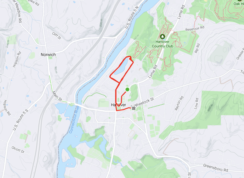
Starting directly on campus, we have the classic Occom Pond loop. Occom Pond has a path that wraps around its entire circumference, making it a popular destination for walkers and runners alike. A Dartmouth Lingo term for any walk around Occom is a "Woccom." I like running Occom loops when I don't feel like going too far or if the weather is unfavorable. A local running group, the "Upper Valley Run Club," hosts speed workouts around Occom every Tuesday. As a part of Club Triathlon, I can attend these for free—which makes for a fun, challenging afternoon (though I can't say I go every week).
The loop! Or loop(s)
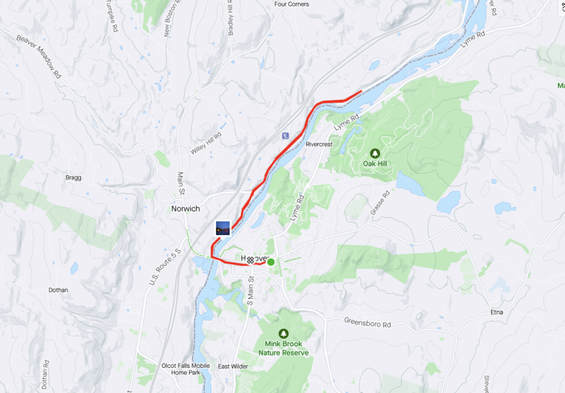
Moving directly North, we have River Road, which is probably one of the most scenic routes; it follows the Connecticut River for what feels like forever. I usually run past the green, turn right onto West Wheelock Street, and eventually turn again onto River Rd. West Wheelock St. is a massive hill, so getting to River Rd. is fine (downhill), but coming back can be quite the climb. I should also mention the Connecticut River is the border between Vermont and New Hampshire, which makes River Rd. a multi-state running route?!
You can go as far as you want... really.
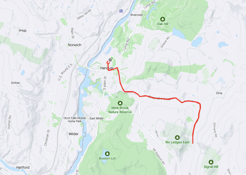
Moving South, we have Lebanon Street and Greensboro Road. Both bring you to a quaint residential area. This out-and-back is good if I'm leaving the gym and I don't want a route with lots of hills. I would say the biggest challenges in finding good routes are knowing where the most elevation gain is and how much traffic exists because both will dictate how pleasant the run is.
I have yet to become ambitious enough to turn this into a full loop.
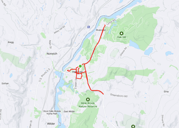
Lastly, there's Lyme Road, which also follows the Connecticut River—but not directly next to the shoreline. I take Lyme Road past the Life Sciences Center, continue straight at the rotary, and typically turn around when the sidewalk ends. Lyme Road also goes past the old Dartmouth Golf Course, which has since been converted to trails connecting with Pine Park (another great route, perfect for light trail running).
Here I kind of went all over—but I did go up Lyme Rd. for a bit!
As I begin my junior year, I feel my time at Dartmouth shifting from exploration to deeper focus, with my studies, experiences, and passions beginning to take clear shape.
As a senior now, I've experienced and learned more about myself and about life than I ever anticipated I could. With that, I want to reflect on Dartmouth's unique qualities, from its rural setting to the Greek Life presence to the quarter system!
New Hampshire is such a glorious state with so much to offer in the fall! Come with me as I explore Plainfield, NH, and go apple picking at Riverview Farms.
Now that I'm a sophomore, I find myself in the possession of an extraordinary amount of 'Dartmouth lingo.' This is your formal invitation to get the inside scoop!
Now that I'm officially halfway through my Dartmouth career, I'm acutely aware of how fast time seems to fly. It seems like years ago that I first experienced Fallapalooza, a free concert for Dartmouth students hosted by Programming Board.